Mid-October is the perfect time to enjoy the brilliant yellows, reds and oranges of Pennsylvania's hardwood forests. And, as it turns out, the cooler weather is great for spotting otters and other wildlife. In less than two days, we managed to hit many highlights along the 47-mile long Pine Creek Gorge in north central PA.
 |
| Looking downstream from Leonard Harrison State Park lookout, far left |
 |
| Tiny frog on Turkey Path Trail in Colton Point State Park |
 |
| From base of Turkey Path Trail in Colton Point State Park |

For several years now, we have been wanting to visit the Grand Canyon of Pennsylvania, as the winding cliffs and hills carved by Pine Creek in north central PA is known. But compared to other areas in the northeast, that region of PA is conspicuously lacking when it comes to electric car charging stations. Last Thursday, we borrowed the kids' Mercury Milan hybrid and set out for the northern end of the canyon. Our goal was to visit two state parks facing each other on opposite sides of the gorge. The Leonard Harrison State Park on the east rim is more easily accessible from the Philadelphia area, and has the reputation for getting overcrowded. So we planned on visiting this park first, retreating to the more remote Colton Point State Park on Friday.
Leonard Harrison State Park - Thursday afternoon
2 pm - We arrived at the parking area for the paved, accessible overlook around 2 pm, after having stopped at the Park Office on the way in to pick up a map and stickers for the Pennsylvania State Park Passport. There is a small gift shop and museum with more maps, and venders for ice cream and snacks that seem to be open until 4 pm in the overlook complex itself.
 |
| Possibly the most photographed pine tree with view beyond, straight out from the overlook archway. |
The overlook itself turned out to be a lot longer than we had thought initially, with steps that descend to additional tiers to the left. As our goal was to hike down to the Pine Creek Rail Trail at the bottom via the Turkey Path Trail, we took a few quick photos directly opposite the entrance arch and then headed immediately down the 1.2 mile path to the bottom.
 |
| Turkey Path Trail in Leonard Harrison State Park |
The first half of the descent is pretty easy, with broad switchbacks leading to a lookout near the top of a waterfall on Little Four Mile Run. There was only a small trickle of water at this time of the year, although you can see the cascading drops as you walk along the trail.
 |
| Dry waterfall |
The final third of the path consists of a bunch of wooden steps leading to the flat rail trail bike path at the bottom. It was hard at first to find a way down from the bike path to Pine Creek itself, and my husband ended up going under the bridge and climbing through fallen trees before he noticed the easy way down, which he pointed out to me.
 |
| Passing under the bridge and over sticks to get to Pine Creek |
There is a little path down (arrow) that begins just to the left of the bridge and to the right of the information placard.
 |
| The easy way down... |
The stream was absolutely beautiful from the rocks at its shore. It was low enough to cross, particularly with watertight hiking boots. As we discovered the following day, the trail leading up to Colton Point is across and to the right.
 |
| View upstream. The Colton Point portion of the Turkey Path Trail is on the opposite shore around where the grass ends |
After spending about 10 minutes at the bottom, it was time for a difficult climb back to the top. I had to stop several times to allow my heart rate to drop from the maximum range for my age to 85-90%. Luckily there were conveniently spaced benches built into the steps, and things got a lot easier in the switchback phase towards the top. It took just over 1.5 hours for the round trip.
 |
| A solid bank of wooden steps lead back up Turkey Path Trail. |
3:45 pm - Next up was a shorter, easier trek to Otter Point via the Overlook Trail. This view is well worth the 0.6 mile loop hike.
 |
| Nice easy stretch of the Overlook Trail |
The pamphlet recommends following the path in a clockwise direction, but we accidentally did it counterclockwise because we did not notice the left branch going downhill past the old CCC incinerator. Staying right past the incinerator made for a shorter, steep descent to Otter Point.
 |
| Looking downstream from Otter Point |
4:10 pm - We ended our visit by exploring the rest of the paved lookout going down the steps to the left.
 |
| Wildflowers and fall leaves |
The lighting had changed dramatically in the two plus hours that we spent at Leonard Harrison State Park, and we took many more photos.

There was a nice sign for points of interest across the gorge, but it was hard to see into the shadows cast by the hills in the fading afternoon light.
 |
| Looking upstream from Leonard Harrison State Park lookout, far left |
Hampton Inn & Suites, Mansfield, PA - Thursday & Friday nights
The closest community to the two state parks is Wellsboro, PA. This is a charming town with broad road verges wide enough to house majestic red- and gold-leafed oak trees, with attractive late Victorian and Revival homes on the drive in to the historic district and village green. Unfortunately, everything was booked more than one week out, so we ended up staying at the Hampton Inn & Suites in Mansfield, PA, a bit further up the road.
This is the first hotel we have stayed in since the coronavirus pandemic, and we were pleased with the safety precautions taken by the hotel. All handles and surfaces were sanitized and the doors sealed. There were ample hand sanitizer dispensing stations, and everyone followed the indoor mask guidelines at the buffet. The rooms were equipped with microwave and refrigerator. We chose to take our breakfast back to the room, using the microwave to reheat the eggs, bacon and oatmeal.
For dinner, we drove a short distance to the main street area, where decorative horse hitching posts announced 2 h of free parking.
 |
| Lucky Star Chinese Restaurant on the main street in Mansfield |
We ordered an appetizer, soup and entree from Lucky Star Chinese Restaurant, and received more than enough food for both Thursday and Friday night dinners. After stopping in the hotel breakfast area to pick up paper bowls, we enjoyed pan-fried pork dumplings, roast pork yat gaw noodle soup, and the chefs special orange flavor chicken.
 |
| Orange flavored chicken, pan-fried pork dumplings and bbq pork noodle soup. |
The soup came in a light broth with slices of chinese bbq pork, broccoli, snow peas and some sort of tender cabbage (possibly nappa). The entree container was surprisingly heavy, packed full of chicken chunks in a rich sauce containing orange peel and a few broccoli florets. This dish was our favorite of the trip.
Colton Point State Park - Friday morning
 |
| Driving to the west rim of the "Grand Canyon" on a drizzly morning |
While Thursday had been a beautiful, warm, sunny day, Friday turned out to be cool and drizzly. This made for dramatic morning views with clouds accentuating many of the furrows between ridges. Plus we pretty much had the Colton Point Turkey Path Trail down to the creekbed completely to ourselves. We only ran into one couple on our way back up, although the scenic Rim Trail at the top was a bit busier.
 |
| Misty morning from the first scenic viewpoint at Colton Point State Park |
10 am - We arrived at the first of 5 scenic overlooks along Colton Point, which gave a good view of a broader region of Pine Creek compared to the lookout at Leonard Harrison. To get to the trailhead for both the Turkey Path Trail and the Rim Trail, stay to the right and park in the last parking area before the small one-way loop at the end. The trails share a common stem, before the Turkey Path Trail breaks off to the right.
This trail is a bit longer than its counterpart in Leonard Harrison, and it was actually easier from a cardiovascular stand point. However, it was a more difficult, riskier trail to follow. First, it was not well blazed at all, and the blue blaze was missing or so worn it was hard to see at the key points. The beginning of the trail consists of numerous switchbacks. People taking shortcuts had taken their toll and it was not always easy to determine trail from eroded shortcuts.
 |
| Lots of switchbacks in the early descent of Turkey Path Trail from Colton Point |
Again, the waterfall halfway down the trail was pretty much dry, although you could see some decent cascades through the trees. After the waterfall, the trail split into an uphill trail on the left and a nice easy trail going downhill to the right.
 |
| The trail was poorly blazed, but the uphill trail is correct |
We started on the uphill trail because there was a blue ribbon tied to a tree and it seemed to fit the map showing that the trail stays at roughly constant elevation until it wraps to the other side of the ridge. However, the trail became so narrow and slanted at places that it was hard to traverse, and we began to wonder if we had taken a wrong turn.
 |
| Parts of the trail are in the process of being washed down the slope. |
My husband went back and tried to follow the lower trail, before it petered out. He concluded that it was probably there to provide a better view of the cascades, non-existent at this time of year.
So we pushed on ahead past dramatic rock ledges to find that the upper trail opened up into quite a nice trail once you got past the rocks. He spotted a tiny little frog on a leaf in the path and waited to make sure I did not accidentally step on it (see photo above).
The trail stayed pretty level until you could see Pine Creek below, after which it descended via 2 or 3 easy long switchbacks to the water. Across and to the left, we could see the bridge at the bottom of the trail we had taken yesterday.
 |
| View of the bridge at the bottom of the Leonard Harrison portion of Turkey Path Trail |
It finally made sense why the path had the same name at both parks -- after wading the river, you could essentially continue up to the other rim. I still think it would be easier if they had added East and West to the trail name in the two parks, respectively.
 |
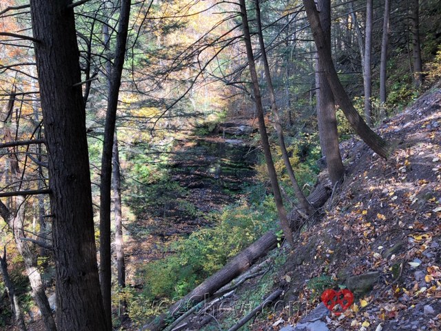
| Looking upstream from the base of the Colton Point portion of Turkey Path Trail |
12:30 pm - After completing the 3 mile trip to the bottom and back, we turned right to follow the Rim Trail, catching three of the four lookouts along the front of this trail over the next 20 minutes.

By then we were feeling hungry, so we hiked back to car and drove back to the Dumpling House in Wellsboro for lunch. Parking meters only accepted quarters for an hour of parking, so we were happy to find change in the car. The restaurant was takeout only, and provided chlorox wipes and hand sanitizer. After we ordered, we noticed the special of six scallops for only $2.45! The tasty vegetarian dumplings really hit the spot, and the pan-fried pork dumplings were spurted juice like soup dumplings.

Barbour Rock Trail - Friday afternoon
2:40 pm - After lunch, we returned part-way up Colton Road to the Barbour Rock Trail Head. There are two trails here, a blue-blazed, slightly longer wheelchair accessible crushed gravel trail and a more direct yellow-blazed loop trail. We stayed to the left to take the yellow trail in a clockwise direction. This led to a nice lookout.
We then took the red-blazed West Rim Trail to the right until it opened up into the most expansive view of Pine Creek Gorge off of a broad downward sloping ledge. There is no guard rail in this area, but it is possible to get a great view while staying well back from the edge.
 |
| Expansive views from Barbour Rock |
Continuing to the right along West Rim Trail, a 30 mile long backpacking trail that is different from the easy Rim Trail in the state park, leads to a large overlook at the end of the wheelchair accessible path.
After this 25 minute excursion, we got some ice cream and returned to the hotel for an afternoon nap.
Driving Route 414 & Hyner View State Park - Saturday morning
After checking out of the hotel, we drove down PA 414, gaining beautiful views of wildlife, foliage and water. At the Blackwell Canoe Access, we saw three deer that went down to drink from the creek before crossing it.
 |
| Whitetail deer |
We also took in some fantastic views at Rattlesnake Rock and on various bridges as Route 414 crossed from one side of Pine Creek to the other.
 |
| Rattlesnake Rock |
 |
| Driving South along PA 414 |
At one point, we saw two river otters who popped their heads up out of the water to look at us, scolding us for interrupting their peace. Then they got used to us and one of them caught something to eat.
 |
| Pair of curious river otters |
We left Pine Creek to head west on PA 44 past Upper Pine Bottom State Park on our way to our final destination of this trip. I had read in the Seasonal Guide to the Natural Year by Scott Weidensaul that the view from Hyner View State Park was one of the best in the state, and since Pine Creek empties into the Susquehanna River, we figured this would be a great way to end our fall foliage trip.
 |
| Hyner Run |
While Hyner Run has a pleasant children's fishing area, the real views are up at Hyner View State Park. The road for this is about 0.1 mile past Hyner Run, leading for 4.2 miles up a narrow winding road to a jutting prominence that allows for views over the Susquehanna River Valley in three directions.
 |
| Hyner View State Park |
What a fitting way to end our 2020 pandemic fall foliage mini-vacay!
We definitely want to return in the spring/summer to hike waterfalls, bike the rail trail, seek covered bridges and perhaps paddle sections of Pine Creek or the Susquehanna.
 |
| At Barbour Rock |
Love reading about canyon trips?
Check out The Grand Canyon of the Colorado River Part 1: Dining and Sunset on the Rim
🐾 There is no cell phone service at Leonard Harrison, Colton Point or Hyner Run State Parks. Plan out your navigation steps for leaving these areas before you get there. We did have cell service near Barbour Rock and up at Hyner View.
🐾 You can hike up to the Hyner View point via a 7 mile Huff Run loop trail, or by through hiking the West Rim Trail mentioned above.
🐾 Leonard Harrison and Hyner Run State Parks have camping sites with electric power. Colton Point State Park has only primitive camp sites that are first-come, first-serve.
WHERE ARE YOUR FAVORITE SPOTS TO VIEW FALL FOLIAGE?
Please post comments below or photos to Instagram, Facebook or Twitter
Tag @love2chowblog and hashtag it #love2chow
All photos and content © 2020.
All Rights Reserved. Contact admin@love2chow.com for permissions.
All Rights Reserved. Contact admin@love2chow.com for permissions.
https://www.love2chow.com/2020/10/fall-foliage-at-pa-grand-canyon-pine.html


0 comments